
Cleveland ZIP Delivery Coverage
Cleveland has five postal ZIP codes in the researched set: 37311, 37312, 37320, 37323, and 37364. Three are standard delivery ZIPs, while 37320 and 37364 are PO Box types. The local ZIP code directory is most useful when it begins with that difference. A standard delivery ZIP can help verify the postal label for a complete street address. A PO Box ZIP identifies a postal destination, not an ordinary residential street route.
USPS controls the final delivery result for a complete address. The labels below describe the official research findings, but they do not draw neighborhood boundaries or establish an incorporated-city line.
| ZIP | Areas covered or type | Post office | Local note |
|---|---|---|---|
| 37311 | Standard Cleveland delivery area | Cleveland postal city | A core street-delivery ZIP; the boundary need not equal the city line. |
| 37312 | Standard Cleveland delivery area | Cleveland postal city | Core street-delivery ZIP; verify the complete address. |
| 37320 | Cleveland PO Box ZIP | Cleveland postal service | Do not assume ordinary residential street delivery. |
| 37323 | Standard delivery area with Cleveland postal-city addresses | Cleveland postal city | Exact coverage requires an address lookup. |
| 37364 | Downtown Cleveland PO Box facility | Cleveland postal service | PO Box-only or unique-facility type, not a street-address substitute. |
Cleveland Street Delivery Routes
ZIP 37311, 37312, and 37323 are the standard-delivery portion of the Cleveland postal set. A ZIP is a delivery-route label, so it can cross a municipal line or extend beyond a named neighborhood. That is why an address must be checked in USPS instead of assigned from a static city list. In particular, 37323 is a Cleveland postal ZIP whose exact boundary and covered areas require an address lookup.
Bradley County also contains ZIPs for nearby communities, including 37310 for Charleston and 37353 for McDonald. Those county ZIPs should not be folded into the Cleveland postal set. Postal-city wording is not a substitute for county, municipal, or parcel boundaries.
Note: A Cleveland postal-city label can serve an address beyond the incorporated line, so a ZIP alone does not identify the responsible local office.
Cleveland PO Box Routes
ZIP 37320 and 37364 are PO Box types. The research identifies 37364 with the downtown Cleveland PO Box facility and says it is not a normal residential street-delivery substitute. ZIP 37320 is also a PO Box ZIP. These codes belong in a Cleveland ZIP code directory because they are postal destinations associated with Cleveland, but they should not be used to infer a street location or a group of residents.
This distinction is the local geography interest point: Cleveland's five-code postal set includes two PO Box types, while the postal map still does not equal city limits. A request, assessment result, or deed that uses a PO Box address may identify where mail was sent, not where land sits.
Cleveland USPS Address Check
The official USPS ZIP Code Lookup is the final delivery check for a Cleveland address. Use its address mode or city and state mode, with the complete street address when one is known. The USPS result should be saved before comparing a property record, because assessment and deed records may display a situs address, a different mailing address, or a legal description instead of the postal label.
The USPS lookup screen shown here is the direct official source for delivery verification in a Cleveland ZIP code directory search.
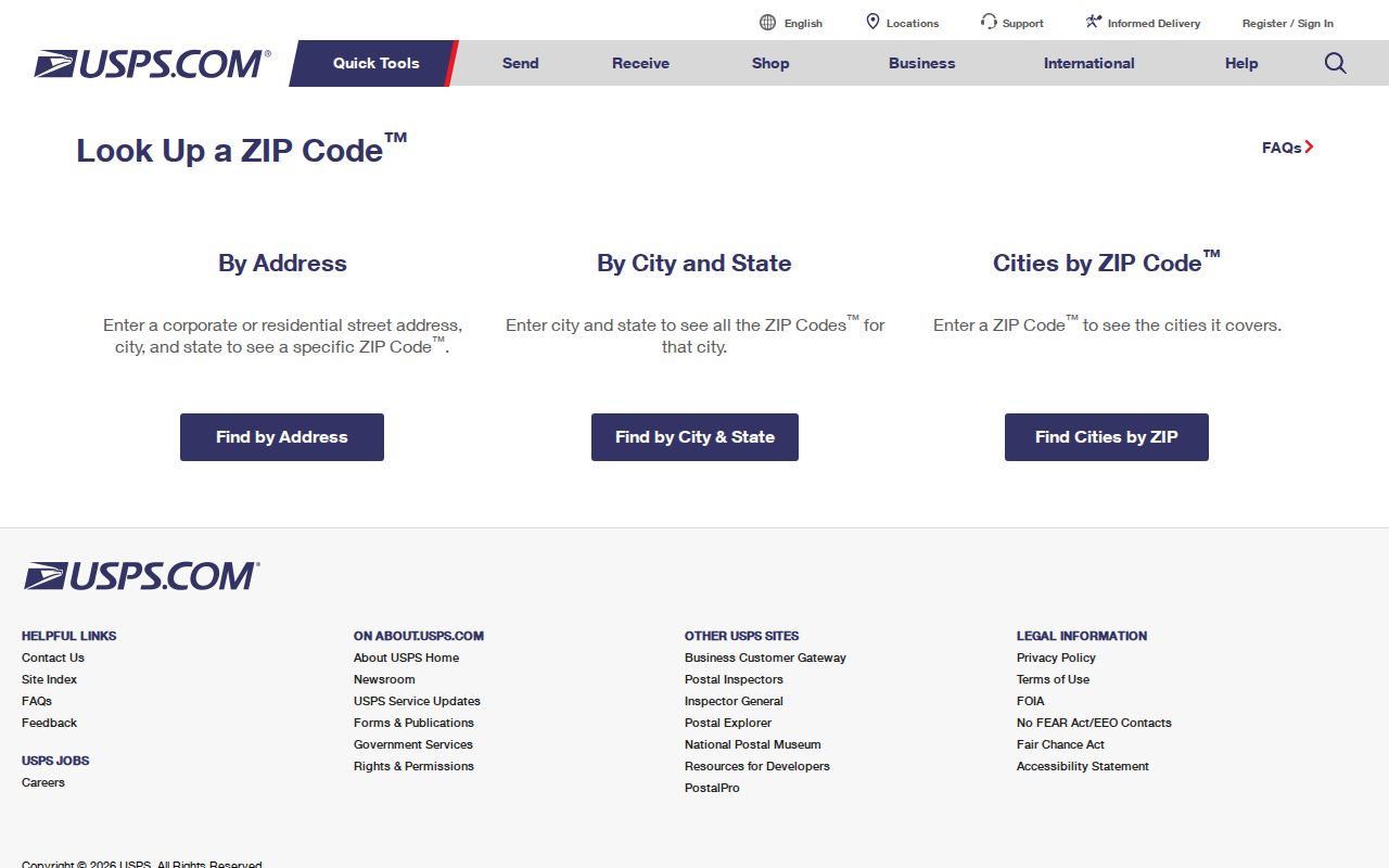
Use the returned ZIP with the full address, not as a rough proxy for a neighborhood, city boundary, or a complete list of people in an area.
| USPS lookup mode | Information to enter | Best Cleveland use |
|---|---|---|
| Address mode | Complete street address | Confirm the delivery city, state, and ZIP for a specific parcel or mailing address. |
| City and state mode | City and state | Check postal labels, then use address mode for the final street-level result. |
Cleveland ZIP Search Limits
No researched Cleveland public portal offers a single ZIP-wide resident button. TPAD documents county, owner, property address, subdivision, classification, sale-date, parcel, and sort fields, but not a ZIP field. The Tennessee Property Viewer searches county, parcel, owner, property address, or subdivision. Tennessee voter lookup also has no ZIP field. A ZIP code directory narrows a delivery question, then moves to a full address or a defined official request.
The practical path is therefore address-first, not list-first. This approach prevents a searcher from presenting an incomplete map result or property result as a complete ZIP resident list.
- Enter the complete Cleveland address in USPS and record the returned city, state, and ZIP.
- Search the same address in TPAD and compare its situs and mailing-address fields.
- Select the parcel in GIS and retain the parcel identifier, map position, and applicable local layers.
- Use the legal description in the deed index if ownership or an earlier transfer must be checked.
- For address-level records along a named road, move to the Cleveland street directory workflow.
Note: A list should never be called complete for a Cleveland ZIP unless it comes from a defined official data extract with known coverage.
Cleveland TPAD Address Fields
The TPAD advanced search is valuable after USPS confirms an address, even though it does not accept a ZIP field. County is required. Optional fields include owner name, property address, subdivision name, classification, sale-date start and end, and parcel components. The parcel structure is Control Map, Group, and Parcel. A property address search can use a street name with an optional number, while the basic form recommends at least three characters.
Use sort choices for owner, address, parcel, subdivision, classification, or sale date to manage a result set. For a ZIP-focused question, the correct method is to verify individual addresses or make a specific public-records request, not to treat a broad property-address search as a ZIP filter.
| TPAD field | Input | Required | ZIP-related role |
|---|---|---|---|
| County | Dropdown | Yes | Choose Bradley to limit the assessment database to the county containing Cleveland. |
| Search Term | Text | Basic search | Use an owner, address, or parcel with at least three characters. |
| Owner Name | Text | No | Check the assessment owner after an address identifies the parcel. |
| Property Address | Text | No | Use the USPS-verified street address; a ZIP field is not documented. |
| Subdivision Name | Text | No | Help distinguish parcels that share local address wording. |
| Classification | Dropdown | No | The static capture did not expose the option list. |
| Sale Date Start / End | Date or text | No | Either endpoint can limit a transfer period. |
| Control Map | Text | No | Three digits, with up to two letters. |
| Group | Text | No | Up to two optional letters. |
| Parcel | Text | No | Five digits, with an optional decimal after the third digit. |
| Sort By | Radio choice | No | Owner, address, parcel, subdivision, classification, or sale date. |
| Search / Reset | Buttons | Action | Run or clear the query. |
Cleveland GIS Postal Context
Bradley County GIS provides links to tax maps, fire districts, voting maps, growth-plan information, zoning, the City of Cleveland online map gallery, assessment data, and the Tennessee Property Viewer. These tools add parcel and district context after USPS verifies a delivery ZIP. They do not certify a ZIP boundary, a neighborhood boundary, or a city limit.
The Bradley GIS page in this image is the local gateway to those mapping resources.
Compare the map-selected parcel with the USPS result. A postal delivery label and a map layer answer different questions, and both may be needed for a reliable Cleveland location check.
Cleveland Address Keys Beyond ZIP
A useful Cleveland postal record keeps three address labels together. The modern situs address is the physical parcel. The mailing address is where tax correspondence goes, which can be outside Cleveland. The legal description identifies the land by a lot, block, subdivision, metes-and-bounds description, or referenced plat. A USPS ZIP describes delivery for an address, not the legal land description.
Parcel numbers are also not ZIP codes. TPAD separates the parcel into Control Map, Group, and Parcel parts. Control Map uses three digits and can include up to two letters. Group can contain up to two optional letters. Parcel uses five digits and may take a decimal after the third digit. Keep these identifiers intact when an address must be checked across assessor, map, and deed sources.
Cleveland Permit Record Paths
Building and code records tend to use an address or parcel, not a postal ZIP. The Cleveland Building Division handles building, electrical, mechanical, plumbing, and historic approvals. Its public information does not show a ZIP-based record lookup. City permit work moves through an account-based process, while county planning and building publishes monthly permit reports for 2024 and 2025.
The Cleveland Building Division page shown here identifies the city division that handles the address-based permit categories.
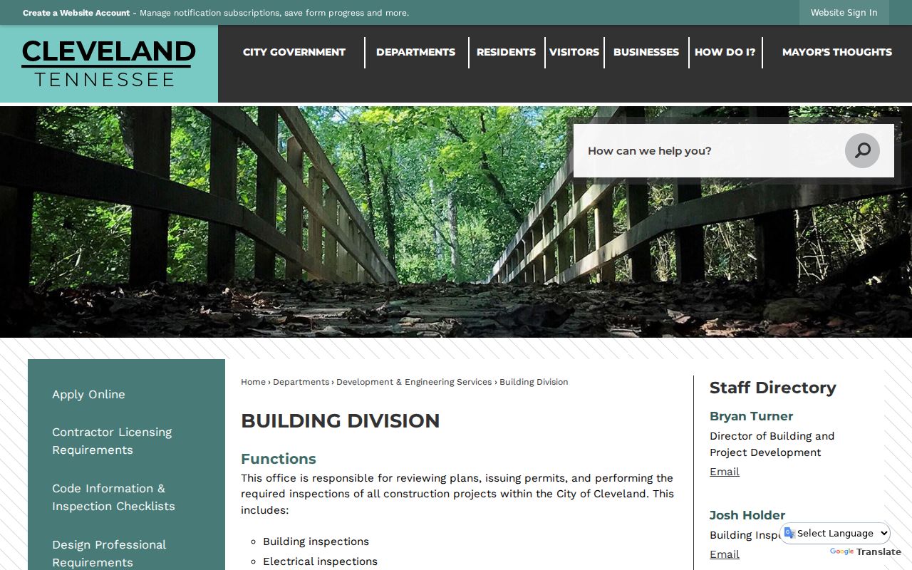
Use the division's address and parcel context when asking about a particular property. The page does not create a ZIP-wide permit lookup.
The Cleveland online permit application page shown here directs applicants to permit-type links and the current process.
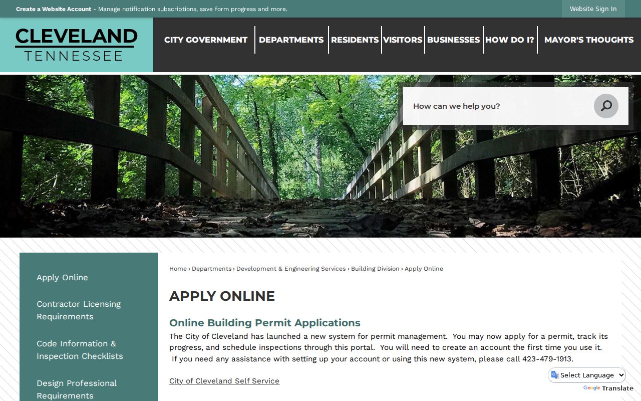
For a prior permit or inspection question, provide the complete street address, parcel number, approximate date, and the record type sought. A ZIP alone will not identify the correct property file.
Note: City EnerGov supports current applications, tracking, and inspection scheduling, but public address-history search results were not exposed in the researched material.
Cleveland ZIP Boundaries and City Limits
Cleveland's postal geography does not line up exactly with municipal or neighborhood geography. A Cleveland postal city can extend beyond the incorporated city line, and a Cleveland parcel can use a postal ZIP whose boundary does not match a neighborhood, council district, fire district, voting map, preservation area, or HELP association boundary. Exact neighborhood-by-ZIP polygons and a historic ZIP split or realignment year were not located in the official sources.
Use postal labels for mail delivery and a full address. Use the assessor, GIS, and legal description for parcel and local-government questions. That distinction matters most for 37323, which should be checked in USPS address mode, and for 37364, which is a downtown PO Box destination rather than a normal street-delivery substitute.
- ZIP
- A postal delivery label for an address or postal destination. It is not a parcel number or municipal boundary.
- ZIP+4
- An added delivery detail used with a ZIP to refine mail routing for a specific address or segment.
- PO Box ZIP
- A ZIP used for post-office boxes. It does not by itself establish a street-delivery location.
- Unique ZIP
- A ZIP associated with a particular facility or postal destination rather than an ordinary broad street-delivery area.
- Carrier route
- A mail-delivery grouping that may assist postal handling but does not define a city neighborhood or parcel boundary.